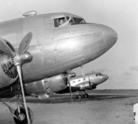
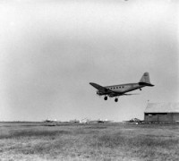
The Waller Field site had been secured from the British in the destroyer-base lease agreement, as was the site for Atkinson Field in British Guiana, the next major staging base to the south. From Waller Field or Atkinson Field aircraft were usually ferried to the base at Belem in northern Brazil and thence to Natal on the Brazilian bulge, although some use was made of alternate landing fields along the way.
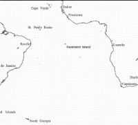
The two bases and Belem and Natal, built with airport development program funds by the Pan American organization, were opened for traffic shortly after Pearl Harbor. Prior to the opening of the base on Ascension Island in July 1942, nearly all two-engine aircraft taking off from Natal for flight over the South Atlantic landed at either Hastings Field in Sierra Leone or Roberts Field in Liberia, each at a distance of approximately 1,900 statute miles from Natal.
Four-engine aircraft were able to fly direct to Accra, but many stopped first at Hastings or Roberts fields for refueling. From Accra aircraft moved in easy stages across the central African route to Khartoum, and here the route divided. India-bound planes were sent either across southern Arabia by way of Aden to Karachi or up through Cairo, Habbaniya, and Basra to the Karachi gateway.
Lend-lease planes for Russia were flown through Cairo to Basra or to Tehran, where they were turned over to Soviet flyers. Aircraft bound for China crossed central India to Dinjan in Assam and were flown over the Himalayas to Kunming. A month or more before the United States entered the war and in anticipation of an increasing flow of lend-lease aircraft to the Middle East, the Ferrying Command had taken steps to place its own control officers at key bases n the southeastern route as far as Cairo.
None of these had reached his post prior to 7 December, but with the coming of the war and the selection of the route for the ferrying of heavy bombers to the Far East, the procurement and assignment of these officers, as well as weather and communications officers and enlisted specialist, was speeded up.
The control officers became responsible for dispatching all United States military aircraft, transmitting arrival and departure reports, providing for fueling and maintenance facilities, making arrangements for feeding and lodging transient crews and passengers, collecting and forwarding intelligence on route conditions, and exercising general administrative control over transient aircraft and crews. Considerable difficulty was experienced at first in securing competent officers to send out.
Regular Army and experienced Reserve officers were more urgently needed in combat units or in the AAF training program. For a time, the Ferrying Command was forced to use young weather or communications officers, only recently commissioned, as control officers at such important bases as Trinidad, Belem, Natal, Accra, and Karachi.
These were gradually replaced by more experienced officers with higher rank who were better able to handle the multitude of problems that came with the great increase in traffic and to control rapidly expanding base organization.
While that segment of the southeastern route from Florida through Brazil was reasonably secure from attack, operations across Africa during most of 1942 were forced to proceed in the face of an ever-present threat of enemy interference. most of the bases along the west coast of Africa and across central Africa were within easy bombing range of Vichy French territory.
More threatening were Rommel's forces in North Africa, for the very existence of the air connection with southern Russia, India, and China depended on the holding of the Middle East crossroads. Should the Germans and Italians have driven the British from Egypt and the Near East, the high strategic value of the southeastern route as it then existed would have been immediately destroyed and the whole line, hinging on Natal, would have been forcibly swung back far to the south.
With this possibility in mind, the War Department early in 1942 directed the survey of an alternate bomber route across Africa and the Indian Ocean to Australia along a line roughly parallel to, and a few degrees south of, the equator. The most feasible route wsa determined to be from Natal to Ascension Island to pointe Noire in French Equatorial Africa, and thence by way of bases in the Belgian Congo and Tanganyika to Mombasa in Kenya Colony, the point of take-off from the east coast of Africa.
Flight across the Indian Ocean was to be made by way of island steppingstone in the Seychelles group or on Coetivy Island, the Chagos Archipelago, and the Cocos Islands to Port Hedland, Australia. Another Indian Ocean route was proposed that would have connected Mombasa with Ceylon or Bangalore, India, by way of Coetivy Island, the Chagos Archipelago, and the Maldive Islands.
A survey of the route across Africa was made by a board headed by Lt. Col. Neil B. Harding. Early in March, Maj. Harold B. Willis of the Air Corps and Lt. Col. Herman B. Pohl of the Corps of Engineers began a joint survey of the Indian Ocean route, making use of a Pan American Clipper for the purpose. Before the Clipper had left the east African base at Mombasa, however, word was received from General Brett in Australia that Japanese operations in the area of the Cocos Islands made the route to Australia no longer practicable.
Willis and Pohl were given orders to proceed no farther than the Chagos Islands. There still seemed a possibility that an alternate air supply line to India might be found, but fortunately the preferable Middle East land route was held and continued in use throughout the war. Nor was it found necessary, as had been considered, to divert all waterborne fighter aircraft to Port Elizabeth in the Union of South Africa for ferrying up the old Cape-to-Cairo airway. Although more exposed to attack, Takoradi and Accra in the Gold Coast Colony continued to be the assembly points for fighter and lighter types of aircraft shipped to Africa by water.
Until February 1942, when the Japanese captured Singapore and overran the East Indies, the southeastern route served as the principal line of air communications between the United States and the Southwest Pacific area. This was, indeed, its most immediate importance. In the first days of the war the Japanese had cut the central Pacific route from Hawaii through Midway and Wake to New Guinea and Australia--the route over which the Far East Air Force had received its thirty-five heavy bombers in the fall of 1941. Considerable progress had bene made by 7 December in the construction of bases for an alternate, more southerly route from Hawaii to Australia through Canton Island, the Fijis, and New Caledonia.
But this route was not ready when orders were issued shortly after Pearl Harbor to rush eighty heavy bombers and crews as soon as they became available to the Far East for the relief of the Philippines. The only other route that could possibly be used was that by way of the South Atlantic and across Africa and southern Asia. Even though it had the marked disadvantage of stretching approximately two-thirds of the distance around the globe, there was no alternative to sending the bombers that way if the President's orders to begin immediately the air reinforcement of the Philippines were to be carried out.
Transcribed by Patrick Clancey - Hyper War Foundation


